|
|
|
|
|
|
|
General Information
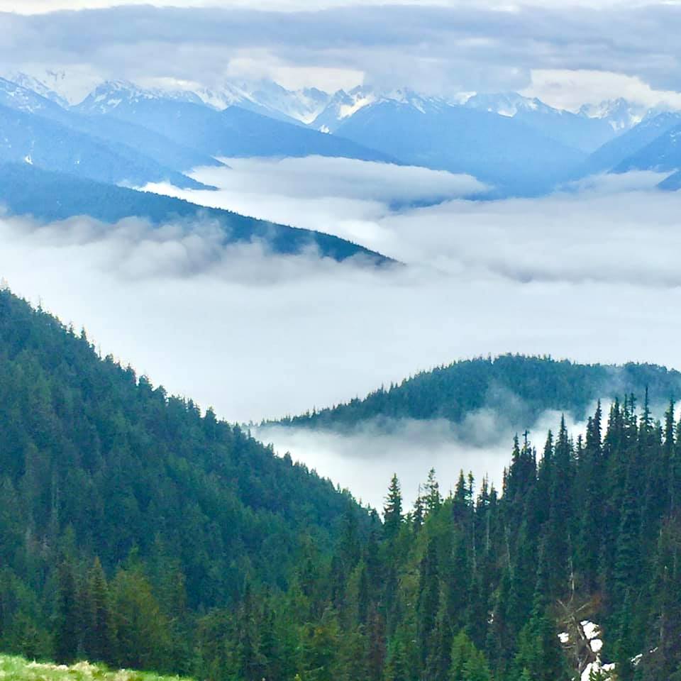
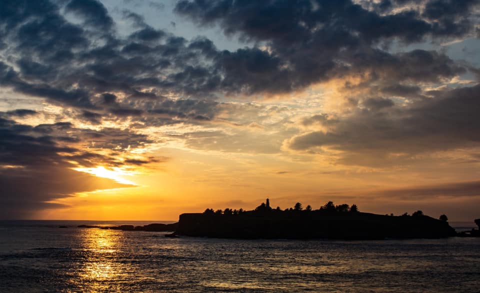
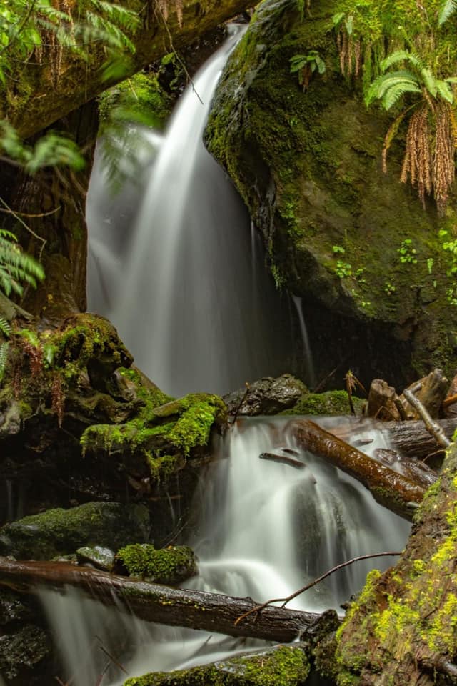
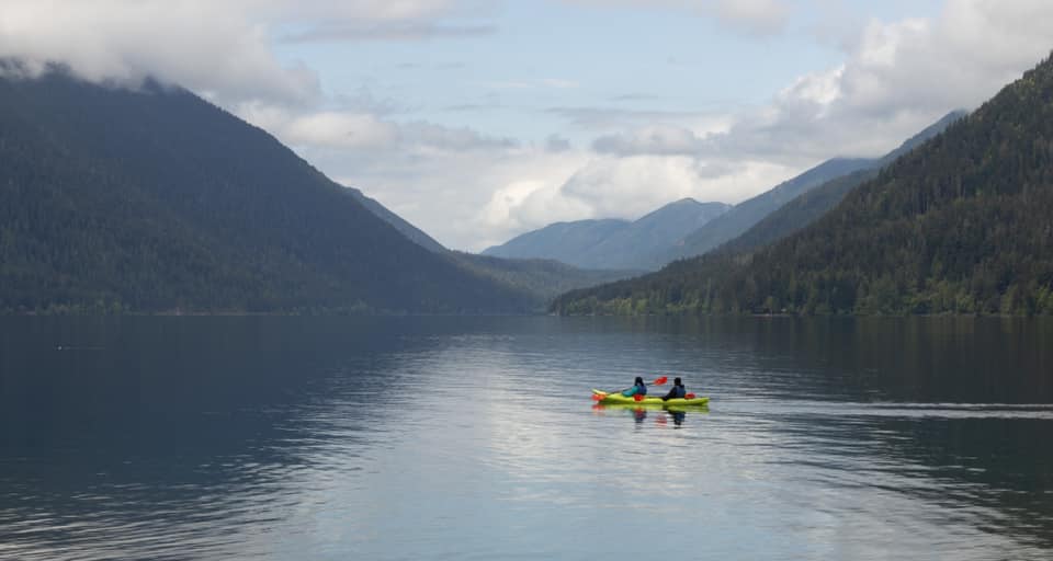
Olympic National Park has a diverse and stunning world, a fog shrouded coast with booming surf and waves-manicured beaches, spectacular alpine country dotted with sparkling lakes, lush meadows, glaciers, and North America's finest temperate rain forest.
Olympic is a wilderness park, with much of its interior accessible only by trail. A variety of spur roads lead to various destinations around the park. Scenic drives to Hurricane Ridge, along the Pacific Coast and through the forested valleys of the Sol Duc, Hoh and Quinault Rivers provide glimpses of Olympic's diversity.
Establishment
The act establishing Olympic National Park was signed on 29 June 1938 by President Franklin D. Roosevelt and in 1988 nearly 96 percent of the park was designated as wilderness.
In 1885 the first systematic exploration of the interior of the Olympic Peninsula was made. Theat year Lt . Joseph P.O.'Neil led the first documentated expedition into the interior. In 1889 - 90, the Press expedition led by James Christie made a north - south crossing in five and one half months. In 1890 Lt. O'Neil returned and made an east - west crossing. Slowly a movement got underway to set aside some of the peninsula as a national park. In 1897 President Grover Cleveland created the Olympic Forest Reserve, a portion of which President Theodore Roosevelt designated a national monument in 1909. In 1938, President Franklin D. Roosevelt signed legislation creating Olympic National Park and in 1988 nearly 99 percent of the park was designated as wilderness.
Size and Visitation
Over 1,400 square miles lay within the boundaries. In 1988, 876,000 acres were set aside as a formal wilderness which is 95 percent of the park land.
Often referred to as "three parks in one", Olympic National Park encompasses three distinctly different ecosystems -- rugged glacier capped mountains, over 60 miles of wild Pacific coast and magnificent stands of old-growth and temperate rain forest. These diverse ecosystems are still largely pristine in character -- about 95% of the park is designated wilderness.
Most visitors come to the park from July through September; December and January are the quietest months.
Olympic is a wilderness park, with much of its interior accessible only by trail. A variety of spur roads lead to various destinations around the park. Scenic drives to Hurricane Ridge, along the Pacific Coast and through the forested valleys of the Sol Duc, Hoh and Quinault Rivers provide glimpses of Olympic's diversity.
History
Since the early 16th century European explorers had sought a Northwest Passage across the American continent to the Pacific. A Greek navigator who sailed for Spain and was known by the name of Juan de Fuca claimed to have found such a passage at 47 N latitude in 1592, but his claim was doubted by subsequent explorers. Captain James Cook, in March 1778, paused off the northwestern tip of the Olympic Peninsula, which he named Cape Flattery because an opening along the coast "flattered" the Captain and crew with the hope of finding a harbor. Cook noted in the logbook: "In this very latitude geographers have placed the pretended Strait of Juan de Fuca. But nothing of that kind presented itself to our view, nor is it probable that any such thing ever existed." In 1787 the English Captain Charles William Barkley recognized the passage between the Olympic Peninsula and Vancouver Island and entered it onto his charts as the Strait of Juan de Fuca. On July 4, 1788, British Captain John Meares named Mount Olympus (which had been called El Cerro de la Santa Rosalia by Spanish explorers). He also sent a small party to explore the Strait. In 1792 the Strait and Puget Sound were thoroughly investigated by Captain George Vancouver, who named many of the geographical features in this region, including Dungeness, Discovery Bay, the Olympic Mountains, Hood Canal, and Mount Rainier. At about the same time Spanish navigators, also exploring the Strait, named the harbor sheltered by Ediz Hook "Puerto de Nuestra Senora de los Angeles," the present day Port Angeles.
Settlers came to the north Olympic Peninsula in the mid-1800's, but the mountainous interior remained unexplored. Although there are unconfirmed accounts of an ascent of Mount Olympus by two white men and two Native Americans from Cape Flattery in 1854; the crossing of the peninsula by a shipwrecked crew and passengers in 1855; and an expedition led by Melbourne Watkinson in 1878, the first well documented exploration of the Olympics occurred in the summer of 1885. Army Lieutenant Joseph P. O'Neil led a small party of enlisted men from Vancouver Barracks and civilian engineers on a reconnaissance of the Olympic Mountains. O'Neil chose Port Angeles, at the time a town of about forty inhabitants, a hotel, a sawmill, and two stores, as his starting point because of its nearness to the mountains. On July 17, the party headed south into the foothills following a route similar to the present-day Hurricane Ridge Road, making slow progress cutting a trail through dense forest and windfalls. It took them about a month to climb to Hurricane Ridge. From there part of the group began to explore the Elwha Valley while O'Neil and the others headed southeast. O'Neil explored almost as far south as Mount Anderson before a messenger reached him with orders to report to Fort Leavenworth, Kansas, and the expedition was cut short.
A second assault on the Olympic interior was made in the winter of 1889-1890. During the fall of 1889, the year Washington became a state, the Seattle Press newspaper called for "hardy citizens . . . to acquire fame by unveiling the mystery which wraps the land encircled by the snow capped Olympic range." This call was answered by James Christie, who volunteered to organize an expedition if the Press would finance it. The Press Party consisted of six men (one of them left the expedition early; five completed the trip) whom the Press described as having "an abundance of grit and manly vim," four dogs, two mules, and 1500 pounds of supplies. This group entered the Olympics in December 1889, one of the harshest and snowiest winters in the Peninsula's history.
Christie had planned to follow the Elwha River into the heart of the mountains, transporting supplies on a large flat-bottomed boat, Gertie, which the men built. The boat leaked and had to be hauled over log jams and towed through rapids by the men, wading through deep snow along the banks or in icy water sometimes up to their chins. After twelve frigid, exhausting days, Gertie was abandoned. The party spent January - April 1890, exploring the Elwha Valley. In mid-March the explorers discovered and named Geyser Valley, where they heard sounds they thought were bubbling geysers although there are none in the valley. (James Christie predicted Geyser Valley would make "a young paradise for some venturesome squatter," and ten years later Will and Grant Humes homesteaded in the valley. The Humes cabin can still be visited today, about 2.5 miles from the Whiskey Bend trailhead.) In early May, the Press Party, their clothes in tatters and running dangerously low on supplies, crossed Low Divide and headed down the Quinault Valley, reaching the coast on May 20, 1890 after nearly six months in the mountains. As a result of the Press Expedition, many peaks bear the names of prominent newspaper publishers and editors of the late 19th century, including Mt. Meany (named after Edmond Meany, an editor of the Seattle Press), Mt. Dana, Mt. Lawson, Mt. Noyes, Mt. Scott, and the Bailey Range. Press Party blazes can still be found along the Elwha River trail in the park.
Also during the fall and winter of 1889, Charles Gilman and his son Samuel explored the Quinault River valley and the western slopes of the Olympic Peninsula. In the summer of 1890 Lieutenant Joseph O'Neil, accompanied by a group of scientists from the Oregon Alpine Club, led a second Army expedition across the peninsula from Hood Canal to the Pacific coast. This well organized expedition cut a serviceable mule trail as it went and several smaller parties were sent out to thoroughly explore large sections of the eastern and southern Olympics. One of these parties ascended Mount Olympus in September 1890. While in the eastern Olympics that summer O'Neil met a small hiking party led by Judge James Wickersham, who had ventured into the Olympic Mountains the previous summer also. As a result of their explorations, both Wickersham and O'Neil advocated the establishment of a national park in the Olympics. O'Neil wrote in his 1890 report: "In closing I would state that while the country on the outer slope of these mountains is valuable, the interior is useless for all practicable purposes. It would, however, serve admirably for a national park. There are numerous elk--that noble animal so fast disappearing from this country--that should be protected."
In 1897 most of the forested land of the peninsula was included in the Olympic Forest Reserve (later Olympic National Forest). Following O'Neil's recommendation, Washington state Congressmen introduced unsuccessful bills in the early 1900's to establish a national park or an elk reserve. In 1909, just before leaving office, President Theodore Roosevelt issued a proclamation creating Mount Olympus National Monument within the national forest to protect the summer range and breeding grounds of the Olympic elk. Mount Olympus, along with all other national monuments was transferred to National Park Service administration as part of President Franklin D. Roosevelt's governmental reorganization in 1933 and with the support of national conservation organizations, Washington Congressman Monrad C. Wallgren in 1935 sponsored a bill for the establishment of a national park. After a visit to the Olympic Peninsula in the fall of 1937, President Roosevelt added his enthusiastic support to the movement for a national park, and the act establishing Olympic National Park was signed on June 29, 1938. The coastal strip was added to the park in 1953. In 1976, Olympic National Park became a Man and the Biosphere Reserve, and in 1981 it was designated a World Heritage Park.
Peaks bear the names of prominent newspaper publishers and editors of the late 19th century, including Mt. Meany (named after Edmond Meany, an editor of the Seattle Press), Mt. Dana, Mt. Lawson, Mt. Noyes, Mt. Scott, and the Bailey Range. Press Party blazes can still be found along the Elwha River trail in the park. Also during the fall and winter of 1889 Charles Gilman and his son Samuel explored the Quinault River valley and the western slopes of the Olympic Peninsula. In the summer of 1890 Lieutenant Joseph O'Neil, accompanied by a group of scientists from the Oregon Alpine Club, led a second Army expedition across the peninsula from Hood Canal to the Pacific coast. This well organized expedition cut a serviceable mule trail as it went, and several smaller parties were sent out to thoroughly explore large sections of the eastern and southern Olympics. One of these parties ascended Mount Olympus in September 1890. While in the eastern Olympics that summer O'Neil met a small hiking party led by Judge James Wickersham, who had ventured into the Olympic Mountains the previous summer also. As a result or their explorations, both Wickersham and O'Neil advocated the establishment of a national park in the Olympics. In 1897 most of the forested land of the peninsula was included in the Olympic Forest Reserve (later Olympic National Forest). Following O'Neil's recommendation, Washington state Congressmen introduced unsuccessful bills in the early 1900s to establish a national park or an elk reserve. In 1909, just before leaving office, President Theodore Roosevelt issued a proclamation creating Mount Olympus National Monument within the national forest to protect the summer range and breeding grounds of the Olympic elk. Mount Olympus, along with all other national monuments, was transferred to National Park Service administration as part of President Franklin D. Roosevelt's governmental reorganization in 1933, and with the support of national conservation organizations, Washington Congressman Monrad C. Wallgren in 1935 sponsored a bill for the establishment of a national park. After a visit to the Olympic Peninsula in the fall of 1937, President Roosevelt added his enthusiastic support to the movement for a national park, and the act establishing Olympic National Park was signed on June 29, 1938. The coastal strip was added to the park in 1953. In 1976 Olympic National Park became a Man and the Biosphere Reserve, and in 1981 it was designated a World Heritage Park.
The Coast
More than 60 miles of Pacific Ocean coastline form a vital component of Olympic National Park. This coastline has remained little changed except for the impact of the pounding surf and storms. It looks much as it did when American Indians built their first villages thousands of years before European explorers arrived. Today the Hoh, Jamestown S'Klallam, Lower Elwha Klallam, Makah, Port Gamble S'Klallam, Skokomish, Quileute and Quinault continue to live along the peninsula's shores where their ancestors arrived so long ago.
The coast is where the land meets the sea, vibrating with life and energy. Arches and sea stacks; the roar of crashing waves; the calls of gulls, bald eagles, and black oystercatchers; dramatic sunsets; the vastness of the ocean and a myriad of other elements impress themselves upon you. Scooping up a handful of sand, you discover that it is virtually impossible for you to count the shades of colors or to classify shapes, so varied are the grains. At low tide you can walk toward the surf stopping at tidepools along the way. If you squat down and spend some time just looking, you will be amazed at what you see as your eyes start ferreting out objects that look like rocks, but which in fact are small sea animals. Slowly extending your horizon, you may see some raccoons feeding on shellfish that are reachable now that the tide is out and the danger of the surf is withdrawn. You are likely to find the footprints of shore birds all over the beach, but you will also find those of bear, deer, raccoons, river otters, and a host of other creatures.
The sheer quantity of flotsam and jetsam cast upon the beach is astonishing. Probably the most exotic are the glass floats that Japanese fishermen use to support their nets. It takes the ocean currents about one year to carry the floats across the Pacific to the Washington coast. Among the debris cast upon the shores are huge trees felled from inland stream bank sites by rushing rivers and washed out to sea. They are repeatedly thrown and banged against sand and rock. Limbs are removed and trunks are sanded smooth by the action of the waves. Finally a great storm may toss them high on the beach to join many others.
The Olympic coast is a wild place, a place for endless exploration.
Forests
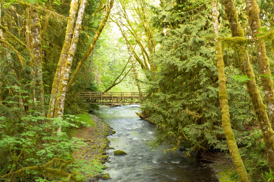
Superlatives about the trees abound, for several specimens reach record sizes. In some locations, the forest canopy is so thick that falling snow is caught in the trees and never reaches the ground.
There are four basic types of forests on the Olympic peninsula: Temperate rain forest, lowland, montane, and subalpine. Temperate rain forest is found at low elevations along the Pacific Ocean coast and in the western-facing valleys of the peninsula where lots of rain, moderate temperatures, and summer fogs exist. Sitka spruce is the dominant tree, but trees typical of the lowland forest also grow here, including western redcedar.
The lowland forest grows further inland from the coast, and above the rain forest valleys. You will not find Sitka spruce here, but you may see grand fir. Western hemlock will probably be the most common tree, although stands of Douglas-fir may prevail where fire or drier conditions caused by the rain shadow give these trees an advantage. Western redcedar is never an abundant tree, but its gradual disappearance is a true indicator that the upper limits of this zone have been reached.
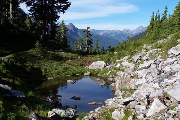
Gradually the lowland forest gives way to the montane forest. Unless you are an expert you may have difficulty recognizing when the change occurs. If silver fir is present you know that you have moved into the montane zone, but in drier parts of the park, the montane zone may look much like the lowland forest, with the exception that the western red cedar will no longer be present.
As elevation increases, temperatures cool and more moisture falls as snow; growing seasons get shorter and the subalpine zone takes over. Silver fir grows here as well as in the montane zone, and in the western portion of the park may be prevalent. The presence of subalpine fir, mountain hemlock, or Alaska cedar groves assure you that this is the subalpine zone. The lower portion of the subalpine zone consists of continuous forest, but in the upper part of this zone the forest thins out. Delightful alpine meadows graced with wildflowers and glacial lakes often intermingle with stands of firs. Subalpine fir is especially well adapted to the heavy snows and cold temperatures experienced here. Its spire-like shape sheds snow. It also extends its lower branches under the snow, often putting down roots from them where they touch the ground. When the snow melts the trees may be surrounded by skirt-like arrangements of longer, lower branches.
Increasing elevation causes even more severe climatic conditions. Trees become fewer, shorter, and more misshapen. Trees may be mere shadows of their cousins living lower down the mountain. Here a 100-year-old tree may be only three feet tall. Eventually tree line is reached, beyond which trees do not grow, but a profusion of wildflowers often rewards your eye in a vivid display that is an effective foil to the scenery below, now visible because the trees no longer block the view.
The Rain Forest
The temperate rain forest in the valleys of the Quinault, Queets, and Hoh rivers are protected and contain some of the most spectacular examples of the Sitka spruce community. This ecosystem stretches along the coast from Oregon to Alaska; other temperate rain forests are found in several isolated areas throughout the world.
What defines a rain forest quite simply is rain--lots of it. Precipitation here ranges from 140 to 167 inches, 12 to 14 feet, every year. The mountains to the east also protect the coastal areas from severe weather extremes. Seldom does the temperature drop below freezing in the rain forest and summertime highs rarely exceed 80 F. The dominant species in the rain forest are Sitka spruce and western hemlock; some grow to tremendous size, reaching 300 feet in height and 23 feet in circumference.
Douglas-fir, western redcedar, bigleaf maple, red alder, vine maple, and black cottonwood are also found throughout the forest. Nearly every bit of space is taken up with a living plant. Some plants even live on others. These are the epiphytes, plants that do not come into contact with the earth, but also are not parasites. They are partly responsible for giving the rain forest its jungly" appearance. Mosses, lichens and ferns cover just about anything else.
Sorrel is also a common ground cover. But because of this dense ground cover it is hard for seedlings to get a start. Many seedlings germinate on fallen, decaying trees. As they grow they send their roots down the log to the ground. Eventually the log rots completely away and a row of young trees is left, up on stilt-like roots, all in a row. The thick and protective vegetation also provides excellent habitats for the animals of the rain forest. In turn, they contribute to the health of the forest by keeping the rampant vegetation under control by browsing.
A temperate rain forest is more than a collection of trees, mosses and other plants. Woven into the fabric is a population of animals including the Roosevelt elk, after whom the park was almost named. Birds such as thrush, western robin, winter wren, pileated woodpecker, gray jay, junco, and raven add texture to the fabric of the temperate rain forest. Mammals such as black tailed deer, cougar, black bear, river otter, Douglas squirrel, jumping mouse, and shrew dwell there. So do insects, reptiles, and amphibians. There are no rain forests in the eastern Olympics. Indicator tree species for the "dry" (100") side are western pine and madrone. Big leaf maples are replaced by vine maples.
How do temperate rain forests compare with tropical rain forests when both are the result of a great deal of rain? In tropical rain forests, the rain tends to be more evenly distributed throughout the year, although there are still "dry" and "wet" seasons. In fact there may be two of each during the year. Rain frequently falls as strong shower bursts. In temperate rain forests, there tends to be one long wet season and a fairly dry summer where fog provides the necessary moisture.
Average temperatures in a tropical rain forest are warmer and tend to vary less during the year, than do daily and nighttime differences. Tropical rain forests tend to look like the "typical jungle" with a profusion of vines and climbing plants such as the strangler figs. The most common trees are broad leaf evergreens; where in a temperate rain forest the most common trees are evergreen conifers, such as the Sitka spruce, western hemlock, western redcedar, and Douglas-fir. The broad leaf trees associated with temperate rain forests, such as big leaf maple, vine maple, alder, and black cottonwood are deciduous, not green. Whereas palm, bamboos, tree ferns, and similar plants grow in tropical rain forests, they are absent on the Olympic Peninsula.
There is a greater variety of plants and animals in tropical rain forests than in temperate rain forests, although surprisingly the latter may support more living material. This is because temperate rain forest trees tend to be taller and bigger around than their tropical counterparts, although the tropical trees often have large swollen bases called flying buttresses. Much more animal life occurs in the canopy of tropical rain forests than in temperate rain forests, ie., a host of monkeys, birds, snakes, and other creatures dwell there, some of which are brightly colored, some of which have loud piercing voices, and some which are poisonous. Most of the animal life in a temperate rain forest are ground dwelling and Olympic National Park has no poisonous snakes. Temperate rain forests are much gentler places on the whole.
Tropical rain forests are much more vulnerable than temperate rain forests. Once destroyed, they require a much longer time for their complex interdependent structures to rebuild. The torrential rains which rapidly leach the soils are probably a key factor as well.
Glaciers
Glacial ice is one of the foremost scenic and scientific values of Olympic National Park. There are about 266 glaciers crowning the Olympics peaks; most of them are quite small in contrast to the great rivers of ice in Alaska. The prominent glaciers are those on Mount Olympus covering approximately ten square miles. Beyond the Olympic complex are the glaciers of Mount Carrie, the Bailey Range, Mount Christie, and Mount Anderson. In the company of these glaciers are perpetual snowbanks that have the superficial appearance of glacial ice. Because they are lacking in the criteria below, they are not true glaciers.
True glaciers are structurally three layered bodies of frozen water. The top layer is snow; the middle neve, or mixed snow and ice; and the bottom layer is of pure ice, which is quite plastic in nature. Crevasses or deep cracks in the glaciers form as the ice is subjected to uneven flow over alpine terrain. Another structural feature is the bergschrund, which is a prominent crevasse-like opening at the head of the glacier where the ice has been pulled away from the mountain wall.
The rate of glacial flow is quite variable and Olympic glaciers are "slow-moving" in contrast to some in Alaska, which occasionally move at the rate of several hundred feet per day for short periods of time. There is no great advance of Olympic glaciers today, but there is not a rapid melting back of the ice either. Forward surges in glacial flow often occur after a number of very heavy winters and cool summers, but such activity has been relatively infrequent with Olympic glaciers in recorded time.
The climate influencing Olympic glaciers is wet and temperate. This is clearly shown in the Mount Olympus complex of glaciers which receive the full impact of Pacific storms. The average annual precipitation is about two hundred inches; most of the moisture coming in the form of snow. Snow nurtures the glaciers in the accumulation zone or at the origin of the ice. Most of the melting or ablation occurs near the termini or snouts of the glaciers. As with human finance management, glaciers work with a budget and expenditure plan. A vigorous glacier will be maintained by a heavy accumulation of snow in the winter and only average melting during the summer. The freezing point in late spring and precipitation in early fall appear to be critical items in relation to this gain and loss. Excessive melt before and after the normal melt season would result in an impoverished budget for the following year.
The movement of glacial ice, past and present has produced striking geological features in the Olympic mountains. The lake basins, U-shaped valleys, and jagged peaks are the products of massive glacial erosion that occurred many thousand of years ago when the year around climate was much colder. This erosion process continues today, but on a much smaller scale. As glaciers advance and retreat, rock is plucked, transported, and deposited by moving ice. The deposition of rock results in medial (middle), lateral (side), and terminal (end) moraines. In many cases, a glacially created bowl (cirque) at the head of a valley will be dammed by a terminal moraine to create a lake basin. The finely ground rock created by the glaciers often makes the glaciated rivers look milky when the glaciers are melting.
The glaciers on Mount Olympus, especially the Blue Glacier have been studied intensely since 1957 by scientific groups seeking valuable data on the composition of an Olympic glacier and how the ice responds to the climate from one year to the next.
Access to the Olympic glaciers is by trails and cross country routes. The most visited glaciers in the Park are the Blue and Anderson. From the Hoh Rain Forest, the upriver hiking trail leads eighteen miles up to the snout of Blue Glacier. Anderson Glacier can be reached by hiking the Dosewallips River Trail for eleven miles or from the west side by the East Fork of the Quinault River for sixteen miles. To visit the other glaciers requires more mountaineering knowledge and time.
Travel on glacial ice is a specialized skill of mountaineering requiring the basic use of climbing rope, ice axe, crampons, and good judgment by the individual climber when accompanied by experienced leaders. The presence of snow bridged crevasses on glaciers is a very great hazard to climbers and no one should attempt glacier travel alone. Self evacuation from a deep, steep walled crevasse is nearly impossible.
Hot Springs
Several hot springs can be found in Olympic National Park, occurring on or near the Calawah fault zone. This presently inactive fault zone extends from the southeastern Olympics to the northwest and probably into the Pacific Ocean. One spring can be reached by walking along an old roadbed for 2.2 miles.
Indian legend speaks of the origin of the Sol Duc and Olympic Hot Springs: Two "dragon-like creatures" (lightning fish) with a mutual hatred for one another engaged in a mighty and desperate battle. There was no victor as both were evenly matched. Admitting defeat each of the creatures crawled into their separate caves where they weep with tears of mortification.
Olympic Hot Springs
The Olympic Hot Springs consists of 21 seeps located in a bank on Boulder Creek, a tributary of the Elwha River. Several of these have been trapped by human-made rock lined depressions. The depth of these pools is about one foot and water temperatures vary from lukewarm to 138 degrees F (54 degrees C). A resort existed in the area until 1966, when the lease expired. Heavy winter snows caused many of the old buildings to collapse. They were removed, but the seeps remain. The impounded pools frequently fail water quality standards for public bathing. Use at your own risk.
Sol Duc Hot Springs
The Quileute name for the hot springs is si'bi', stinky place. In the 1880's, Theodore Moritz nursed a native with a broken leg back to health. In gratitude, the Indian told Moritz of the "firechuck" or magic waters. Moritz staked a claim, built cedar-log tubs and soon people were coming great distances to drink and bathe in the healing water. Michael Earles, owner of the Puget Sound Mills and Timber Company claimed he was cured of a fatal illness after visiting Sol Duc. When Moritz died in 1909, Earles bought the land from his heirs and built a $75,000 road to the springs from Lake Crescent. Three years later, on 15 May 1912, an elegant hotel opened.
The grounds were immaculate - landscaping, golf links, tennis courts, croquet grounds, bowling alleys, theater, and card rooms. A three story building between the bathhouse and hotel held the sanatorium. With beds for one hundred patients, a laboratory, and x-ray it was considered one of the finest in the west.
Four years later, in 1916, sparks from a defective flue ignited the shingle roof of the hotel. The water had not yet been turned on as it was early in the season. Wires were short circuited on the organ and Beethoven's "Funeral" march began to play as the hotel was consumed in flames in just three hours.
The Sol Duc Resort of today may be more modest than the one that existed sixty years ago, but people enjoy the "hot tears" of the Sol Duc dragon. The resort is open from late spring through early fall and offers cabins (some cooking cabins), a dining room, gift shop, a swimming pool, three mineral water pools, therapeutic massage, snackbar, and RV sites.
An 82 unit National Park campground lies on the bank of the Sol Duc River.
Mountains
The Olympic Mountains are not very high, Mount Olympus, the highest, is just under 8,000 feet, but they rise almost from the water's edge and intercept moisture-rich air masses that move in from the Pacific. As this air is forced over the mountains, it cools and releases moisture in the form of rain or snow. At lower elevations rain nurtures the forests while at higher elevations snow adds to glacial masses that relentlessly carve the landscape. The mountains wring precipitation out of the air so effectively that areas on the northeast corner of the peninsula experience a rain shadow and get very little rain. The town of Sequim gets only 17 inches a year, while less than 30 miles away Mount Olympus receives some 200 inches falling mostly as snow.
A number of new theories have been presented recently regarding the origin of the Olympics. Geologists continue to discover new information that contributes to the debate. The following theory is one that has been traditionally accepted for a number of decades.
These mountains have arisen from the sea. For eons, wind and rain washed sediments from the land into the ocean. Over time these sediments were compressed into shale and sandstone. Meanwhile, vents and fissures opened under the water and lava flowed forth, creating huge underwater mountains and ranges called seamounts. The plate(s) that formed the ocean floor inched toward North America about 35 million years ago and most of the sea floor went beneath the continental land mass. Some of the sea floor, however, was scraped off and jammed against the mainland, creating the dome that was the forerunner of today's Olympics.
Powerful forces fractured, folded, and over-turned rock formations, which helps explain the jumbled appearance of the Olympics. Radiating out from the center of the dome, streams, and later a series of glaciers, carved peaks and valleys, creating the beautiful, craggy landscape we know today. Ice Age glacial sheets from the north carved out the Strait of Juan Fuca and Puget Sound, isolating the Olympics from nearby landmasses.
Surrounded on three sides by water and still crowned by alpine glaciers, the Olympics retain the distinctive character that developed from their isolation. Several plants and animals are unique to the Olympics, examples of how genetic diversification occurs when geographical isolation exists. The most striking example is the Olympic marmot, with its distinct chromosonal and behavioral patterns. Others included Flett's violet, Piper's bellflower, Olympic Mountain synthyris, Olympic chipmunk, Olympic snow mole, and Beardslee and Cresceti trout, as well as others.
Record Trees in Olympic National Park
The record size of trees of the following species have been found in the Olympic National Park. The trees are recognized by the American Forestry Association as the largest living specimens of the species in their list of approximately 750 National Champions. The following list gives the size and location of Olympic's record trees:
| Tree | Circumference | Height | Spread | Total Points | Location |
| Alaska Cedar | 451 in | 124 ft | 27 ft | 582 | Quinault Sub-district, Approx 40 ft north of Big Creek Trail, approx 1 mile east of Three Lakes, approx 3,000 ft elev |
| Douglas Fir | 533.5 in | 212 ft | 47.5 ft | 757 | Up Queets River trail (ford river) 2.4 mi to Kloochman Rock Trail; turn left at jct Go 0.2 mi. There is a sign on trail and on tree. |
| Douglas Fir | 448 in | 298 ft | 64 ft | 762 | South Fork Hoh River Trail, 0.25 mile inside Park boundary, 40 ft south of trail. |
| Grand Fir | 229 in | 251 ft | 43 ft | 491 | Along Duckabush River Trail; 7.5 mi from trailhead or 1.5 mi from park boundary, 100 yd past 2nd stream crossing within park on SE side of trail. |
| Sitka Spruce | 707 in | 191 ft | 96 ft | 922 | Near Lake Quinault in Olympic National Forest. |
| Subalpine Fir | 252 in | 125 ft | 26 ft | 384 | Abt 300 ft east/southeast of Cream Lake, located at the head of Hoh River drainage. |
| Western Hemlock (co-champion) | 270 in | 241 ft | 67 ft | 528 | Along Hoh River trail, 100 yds west of Cougar Crossing, 10 yds north of the trail. |
| Western Hemlock (co-champion) | 291 in | 227 ft | 49 ft | 530 | Queets River road 2.8 miles from Matheny Creek, south side of road. |
| Western Hemlock (co-champion) | 316 in | 202 ft | 47 ft | 530 | East side of Wynoochee Trail, 1.2 miles from the road's end. |
| Western Hemlock (co-champion) | 341 in | 174 ft | 65 ft | 531 | 2.0 miles east of Enchanted Valley chalet, below trail. |
| Western Redcedar | 761 in | 159 ft | 45 ft | 931 | North Shore of Lake Quinault, across from Rain Forest Motel. |
Wildlife of the Lowland Forest
Banana Slug Ariolimax columbiana (airy-o-li-max: a compound of two Greek-derived words for slugs; co-lum-be-ay-nus: of the Columbia River)
Physical Description - Up to 6 - 8 inches long, variable in color from yellow to drab green-brown, some with darker spots. Slugs have two tentacles on their head, which tapers to a long body and pointed tail.
Range - the Olympic species of banana slug occupies forests from western Oregon north to southwestern Alaska. Other species of banana slugs are found in western California.
Habitat - Damp lowland forests.
Food - A variety of plant and animal foods are eaten: lichens, leaves (including those of poison oak), mushrooms, animal carcasses and droppings.
Habits - One of the banana slug's best-known attributes is its production of slime, or mucus. This slime is vital to the slug in several ways, by enabling it to slide easily over logs, leaves and whatever else lies in its path. Slug trails can often be found meandering along leaves or smooth rocks. In addition, a thick coating of slime helps protect the slug from dehydration.
Concerns - Although banana slugs are usually found only in their native forest habitat, they are often blamed for the damage done to gardens. Most of this damage is caused by several varieties of introduced European slugs, recognizable by their darker color. Banana slugs remain vital members of the forest ecosystem.
Black Bear Ursus americanus (ur-sus:Latin word for bear; a-mer-i-ca-nus: american)
Physical Description - Head and body 5 - 6 feet long, shoulder height 2 - 3 feet. Black bears on the Olympic Peninsula are unusual in that they are strictly black; in other areas of their range, brown or cinnamon-colored black bears are found.
Range - Forested or mountainous areas throughout North America.
Habitat - In the West, mountainous forested areas are the common habitat, with some bears using open meadows near timberline in summer.
Food - Bears are omnivores, eating many different kinds of foods. Plants make up the bulk of a bear's diet, with tree sap, bulbs, new shoots and grasses being springtime favorites. In autumn, bears seek out and eat huge quantities of berries. Other foods include insects, carrion, fish and small mammals.
Habits - Bears are active in Olympic National Park from early spring through mid-autumn and are found throughout much of the park. In fall, they find or create a den and enter a dormant state for most of the winter. A bear's winter sleep is much lighter than the true hibernation of chipmunks and marmots. When disturbed by melting snow during warm spells bears often wake up, leave the den and explore for several days before returning to the den for the rest of the winter. Many bears in the Olympics den in the lowland forest, moving higher in summer to take advantage of succulent meadow plants.
Deer
Columbia Black-tailed Deer Odocoileus hemionus subspecies columbianus (oh-doe-coe-ill-ee-us: hollow teeth; he-me-oh-nus: mule; co-lum-be-ay-nus: of the Columbia River) The Columbia Black-tailed Deer is a subspecies of the Mule Deer found throughout the western half of North America.
Physical Description - 4.5 feet long plus a 6 to 8 inch tail. Medium tawny brown in summer, gray-brown in winter with white patches on throat, inside of legs and rump just under tail. Tail is dark brown to black. Large (8 to 9 inch) ears. Fawns have conspicuous white spots through their first summer.
Range - Pacific Northwest west of the Cascade Mountains.
Habitat - Throughout the year, deer are found in nearly every habitat of Olympic National Park, from the Pacific beaches to high-country meadows.
Food - Deer are herbivorous (strictly plant-eating), consuming a wide variety of plants from succulent new spring growth to dry twigs and lichen in winter.
Habits - Deer are generally found in the lowland forests in winter, when they seek moderate temperatures and snow-free conditions. As the snow melts away from the high-country meadows and forests, the deer move up slope for the summer to feed on juicy meadow plants.
Concerns - Black-tailed deer are one of the most commonly seen animals in the park. They often appear to be docile and almost tame, but do not let this fool you! Deer, like any wild animals, are unpredictable and people have been seriously injured by the sharp hooves of a startled or frightened deer.
Cats
Cougar Felis concolor (fee-lis: cat; con-color: all the same color) Also mountain lion, puma
Physical Description - 4 - 5 feet long plus a 2.5 foot tail. Cougars in the northwest are usually a ruddy brown, similar a deer's coloring. Elsewhere, they range from light tan to nearly black.
Range - Cougars are rare in most of their range but are found throughout the western U.S. An endangered subspecies, the Florida panther, is found in the Florida Everglades.
Habitat - Cougars use a variety of mountain habitats from the lowland to the high country.
Food - Cougars are predators, hunting for animals as diverse as grasshoppers, mice, snowshoe hares and even elk. Deer are their main food source.
Habits - Cougars are secretive and generally avoid human contact, though during the past several years, the frequency of sightings in the park has increased. While sightings and cougar - human encounters are still very rare, visitors are encouraged to hike in small groups, rather than alone, and to keep small children closely supervised while hiking.
Concerns - Like most of our continent's large predators, the cougar was systematically eliminated from much of its range during the early part of this century. In protected areas such as Olympic National Park, however, cougars have made a comeback. Their presence in Olympic is an indication of the park's wildness.
Rodents
Deer Mouse Peromyscus maniculatus (Pear-oh-miss-cus: boot mouse; ma-nic-you-la-tis: tiny-handed)
Physical Description - Head and body 3 ˝ to 4 inches long; tail at 4 inches is nearly as long as the rest of the animal. Brown to blue-gray above, white belly and white feet. Tail is bicolored, brown above and white below, often with a white tip. Large eyes and ears.
Range - The deer mouse is the most widespread and common mammal in North America, found throughout the continent with the exception of the southeast corner of the U.S.
Habitat - The deer mouse will live in just about any dry land habitat it can find throughout its range, from forests to grasslands, farm yards to farmhouses. This appealing creature should not be confused with the introduced Eurasian house mouse, which is common only in cities in the U.S.
Food - This small rodent is an omnivore, taking advantage of a wide variety of food sources. In spring they often find grubs or insect larvae; in fall the deer mouse will harvest seeds and berries. This varied diet allows the deer mouse to adapt to a wide range of habitats.
Habits - The deer mouse remains active throughout the winter, often seeking warmth and protection by moving into nearby human dwellings. If no such option is available, deer mice can travel easily over snow and depend on their stored food for the winter. This adaptable mouse is most common in younger or disturbed forests where they can successfully exploit the wide diversity of available food. In older forests, they are out-competed by the more specialized voles that feed heavily on fungus common in ancient forests.
Douglas Squirrel or Chickaree Tamiasciurus douglasii (tay-me-a-sigh-oo-rus: chipmunk squirrel; da-glass-ee-eye: after David Douglas, an early Northwest naturalist)
Physical Description - About 7 inches long, plus a 5-inch bushy tail. Dark reddish gray-brown above (grayer in winter), with a lighter gray or rust-colored belly.
Range - Evergreen forests from California to southwestern British Columbia.
Habitat - Can be found in coniferous evergreen forests from the sea level to near timberline.
Food - Douglas squirrels use a variety of foods, including seeds, nuts, and fungi.
Habits - Douglas squirrels are active throughout the entire year, spending their summers busily gathering and storing food for winter use. Douglas squirrels often harvest unopened cones from evergreen trees, caching them in a storage place until needed. They then carry the cones to a favorite feeding place, usually a tree limb or stump and chew the seeds from the cones. Unused parts of the cones pile up below these feeding places, leaving large mounds or "middens" of cone scales and cores. These squirrels also harvest mushrooms, leaving them on tree limbs to dry before storing them for the winter. The shrill chattering alarm call of the Douglas squirrel is a hallmark of the lowland forest.
Northern Flying Squirrel Glaucomys sabrinus (glawk-a-miss: owl mouse; sa-bry-nus: of the Severn River, Ontario, Canada, where this species was first observed by a European naturalist)
Physical Description - 7 inches long, plus a 5-inch tail. Red-brown above, pale gray on belly. Flying squirrels are distinguished by their very large eyes and long flaps of skin that stretch between their front and hind legs.
Range - Coniferous and mixed forests throughout the northern U.S. and southern Canada.
Habitat - Evergreen or mixed evergreen-deciduous forests. Flying squirrels prefer standing dead or hollow trees for nesting and often nest in old woodpecker holes.
Food - Flying squirrels eat a variety of seeds, nuts and even meat if available. They rely heavily on truffles, a fungus that lives in close association with tree roots and actually increases a tree's ability to absorb nutrients from the soil.
Habits - Flying squirrels cannot really fly, though they are excellent gliders, spreading the extra skin flaps on either side of their body to increase the amount of "wing" surface. They frequently travel through the forest by leaping and gliding from one treetop to a lower limb or trunk, climbing that tree and repeating the sequence. Flying squirrels do not hibernate and are active throughout the year.
Birds
Pileated Woodpecker Dryocopus pileatus (dry-oc-o-pus: wood cutter; pie-lee-ay-tus: crested)
Physical Description - The northwest's largest woodpecker: 15 inches long. (The pileated may be the continent's largest woodpecker as well. The larger ivory-billed woodpecker of southeastern swamps has not been seen in the U.S. since the early 1970's and is feared extinct in this country. Some may remain in Cuba.) All black except for the bright red pointed head crest, white streaks on the head and white underwings visible when the bird flies.
Range - Forests of the north, northwest and eastern U.S. and southern Canada.
Habitat - Mature coniferous or deciduous forests where plenty of dead snags supply habitat for wood-dwelling insects.
Food - Insects and their larvae make up about 75% of the pileated's diet. Seeds and berries are also eaten, usually in summer.
Habits - Woodpeckers are marvelously adapted for their lives of wood-chopping. Their skulls are thicker than most birds' and are filled with a special liquid that absorbs the shock of the bird's head hitting the tree. Pileated woodpeckers can easily chip 3- to 6-inch pieces of wood from a tree while they search for food. Once the hole is made, sometimes as large as six inches across, the bird uses its long, sticky, barb-tipped tongue to reach into the hole and retrieve its insect prey.
Red-backed Vole Clethrionomys occidentalis (cleth-ree-ah-no-meez: keyhole mouse; ox-i-den-tay-lis: western)
Physical Description - Slightly bigger than a keyhole; head and body 4 inches, with a 1.75 inch tail. Gray-brown with a rusty red band down the length of the back and tail.
Range - This species of red-backed vole lives in forests of the Pacific coastal region from northern California north to central British Columbia. Other species live throughout the northern U.S. and Canada to the Arctic.
Habitat - Coniferous forests.
Food - Red-backed voles rely heavily on the fragrant underground fruits of "truffles", a type of fungus prized even by humans as a delicacy. Like flying squirrels, red-backed voles locate their food by smell.
Habits - Red-backed voles are active both night and day.
Concerns - The truffles that red-backed voles thrive on live in close association with the roots of coniferous trees. If the trees are destroyed by a particularly intense fire or other disturbance, both truffles and red-backed voles disappear. Deer mice, with their less specific food requirements, are more likely to be found in younger, regenerating forests.
Elk
Roosevelt Elk Cervus elaphus (sir-vus: the Latin word for deer; el-a-fus: the Greek word for deer)
Physical Description - 7 - 8 feet long (about the size of a large cow, with males sometimes reaching 1000 pounds) plus a 4 - 6 inch tail. Brown with a sharply defined tan rump patch. Darker around neck, head, legs and belly. Males grow large antlers, beginning in early spring. Antlers are fully grown by autumn and are then dropped in early winter. Roosevelt elk are larger and darker than the Rocky Mountain elk found east of the Olympic and Coastal Ranges.
Range - Roosevelt elk were once found on the west side of the Cascades and Coast Ranges from the San Francisco Bay area northward to Vancouver Island, British Columbia. Today they are limited to only a few areas, mostly in managed herds. Olympic's Roosevelt elk herd is the country's largest un-managed population of this subspecies.
Habitat - In winter, elk are found in the lowlands and river valleys. As the snow recedes from the high country, most of the park's elk move up into the mountains, feasting on the summertime wealth of meadow plants.
Food - While they winter in the lowlands of the Olympic Peninsula, elk play an important role in the shape of the forest understory, as they nip off the young shoots of shrubs and low-hanging branches. Elk-inhabitated forests are easily recognized by their open quality the result of the elks' relentless pruning. In summer, elk move to the high country, feeding on the wealth of meadow plants there.
Habits - Elk are well known for "bugling," the characteristic fall mating call of the males. Many autumn visitors to Olympic National Park are startled and then delighted to hear this dramatic wilderness sound. Elk are more frequently seen in quieter situations though, as they graze peacefully in a forest glade.
Concerns - As more of the lowlands become developed outside park boundaries, biologists are concerned that the elk's winter habitat is being diminished, especially on the east side of the park. Scientists from several land management agencies are working together to seek ways to ensure the continued survival of elk on the Olympic Peninsula.
Spotted Owl Strix occidentalis (strix: strident; ox-i-den-tay-lis: western)
Physical Description - The spotted owl is a medium-sized owl, 16 ˝ to 19 inches long. They are dark brown, white-spotted above and white-barred below. Dark eyes.
Range - The spotted owl occupies a discontinuous range, using dense forests of the Pacific slope from extreme southern British Columbia to the San Francisco Bay area. They are also found in forested areas on the western slope of the Sierra Nevada as far south as central California, in the highlands of southwestern California and in the southern Rockies.
Habitat - In the Pacific Northwest, the spotted owl has been shown to be dependent on ancient coniferous forests. Here the structural features of the old forests (many old trees of varying heights, standing dead snags, and extensive amounts of wood on the forest floor) create the owl's necessary habitat. In California, spotted owls have been found to nest in fast-growing second-growth redwood forests, a forest type that exhibits many of the same structural characteristics of old forests on the Olympic Peninsula.
Food - A variety of rodents, especially northern flying squirrels.
Habits - A quiet and well-camouflaged bird, the spotted owl is rarely seen by forest visitors. Its call of two or three short hoots followed by a longer, drawn out hoooo-ah is reminiscent of a far-off barking dog. The spotted owl nests in tree cavities and abandoned hawk nests and usually lays two or three white eggs.
Concerns - The northern spotted owl has been listed as a threatened species by the U.S. Fish and Wildlife Service. Forest managers and scientists are currently studying the status of the spotted owl population as well as the potential of new timber harvest techniques to decrease the impacts of logging on the owl's habitat.
Winter Wren Troglodytes (tra-glod-i-teez: cave dweller, a misleading name for this bird)
Physical Description - At 4 to 4 ˝ inches long, the winter wren is one of North America's smallest songbirds. Its short rounded tail is often held up at right angle to the back. Winter wrens are reddish-brown with very fine bars of lighter color.
Range - Winter wrens are found from southern Alaska to central California, across the continent from the Great Lakes to Florida. Known simply as the Wren in Great Britain, the winter wren also nests in northern Europe, Asia and Japan.
Food - Feeds almost exclusively on insects, although some have been reported to have eaten redcedar seeds.
Habitat - Winter wrens prefer to be near the ground, often hiding near fallen logs or in dense thickets. In spring, you may spy the wren scolding from a branch, or perhaps singing his varied, bubbling song.
Habits - The winter wren is known more by its chatter and song than by its appearance. Like most wrens, the winter wren is quick to notice and announce disturbances to the rest of the forest. Once you locate the sound the bird's scolding and chatter, watch carefully for its darting, almost mouse-like movements in the brush.
Other birds add color and music to the lowland forest as well. As you explore, listen for the high notes of kinglets and juncoes, the characteristic "dee-dee-dee" of chickadees and the loud, raucous caws of the crows and ravens.

Copyright © 1995 - 2007 Hillclimb Media
This site is in no way associated with the United States Government, the Department of the Interior or the National Park Service
